
Percorso Corto
| Distanza | 87 Km |
|---|---|
| Dislivello | 1700m |
| Difficoltà | media |
| Salita più lunga | Litoranea |
| Pendenza Massima | 14% |
| Salita più importante | Volastra - San Bernardino |
Altimetria Percorso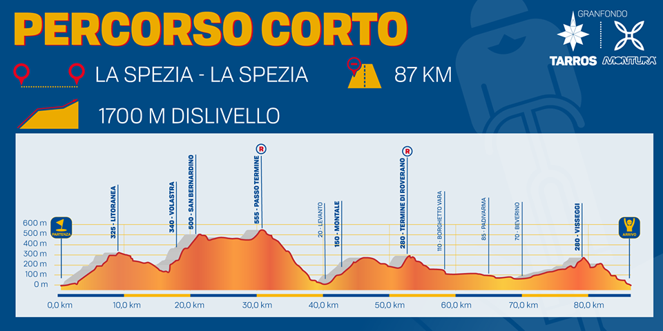   | |
|
Map of the route “Granfondo Tarros Montura”: 86.509 m, 3.468 m of climbing and 3.466 m of descent, elevation between 2 m and 557 m, time 08:37:56. It starts at 44.10350, 9.82429 and ends at 44.10627, 9.82774 (latitude, longitude). | |
Percorso Lungo
| Distanza | 109Km |
|---|---|
| Dislivello | 2300m |
| Difficoltà | medio-alta |
| Salita più lunga | Passo Guaitarola |
| Pendenza Massima | 14% |
| Salita più importante | Passo Guaitarola |
Altimetria Percorso 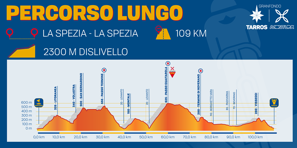 | |
|
Map of the route “Granfondo Tarros Montura”: 108.562 m, 4.445 m of climbing and 4.444 m of descent, elevation between 2 m and 625 m, time 10:52:04. It starts at 44.10353, 9.82424 and ends at 44.10837, 9.82679 (latitude, longitude). | |